
Final 4DHydro Workshop Held in Leipzig
The final 4DHydro workshop took place in Leipzig, Germany, on 15–16 September, bringing together project members both onsite and online. A total of 24 participants joined the discussions, sharing results, insights, and future perspectives. Participants present in Leipzig (both online/in-person) included: In-person participants: 24 people online and present: Almudena García-García (UFZ), Luis Samaniego (UFZ), Espen Volden (ESA), Ewelina Dobrowolska (ESA), Albrecht Weerts (Deltares), Stefan Kollet (FZJ), Bram Droppers (UU), Wouter A. Dorigo (TUW), Riccardo Rigon (Uni. Trento), Shima Azimi (Uni. Trento), Félix Frances (UTV), Eshan Modiri (UFZ), Luis Samaniego (UFZ), Husain Najafi (UFZ), Olda Rakovec (CZU), Douglas Clark (UKCEH), Jian Peng; Online Participants: Federico di Paolo (Waterjade), Niko Wanders (UU), Paolo Filipucci (CNR), Luca Broca (CNR), Artemis Vrettou (ESA), Jerome Benveniste (ESA), Diego Fernandez (ESA), Nicolás Cortes (UTV), Nathaly Güiza (UTV), and Hossein Salehi (Uni. Trento). We thank all participants for their contributions and engagement throughout the workshop. For more information, please visit: https://osf.io/m7hqu/files/osfstorage#
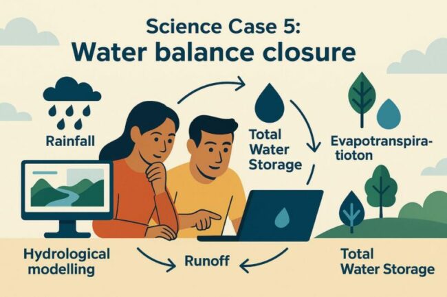
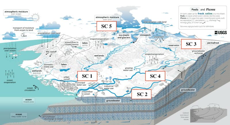
Science Case 5 (led by University of Trento): Water balance closure over all regions
Although high-resolution satellite, hydrological, and land surface models are advancing, accurately understanding the water cycle in catchments remains challenging due to uncertainties in data accuracy, spatial variability, and the complex interactions between surface and subsurface processes. This science case utilizes multiple state-of-the-art Earth Observation (EO) datasets and hydrological/land surface models to close the water budget over the Po, Rhine, and Tugela River catchments. Different experiments (2, 31, 32, and 34) conducted in WP5 will be considered in this analysis. To this end, the study follows a three-step approach. First, the water budget closure performance is evaluated individually for different hydrological models. Second, the capability of EO-based data to close the water budget is assessed by combining EO-derived precipitation and evapotranspiration (ET) with observed river discharge. Finally, the potential of integrating EO-based and model-based data is explored to enhance the accuracy and reliability of water budget closure. The findings indicate that water budget components derived from models calibrated using river discharge in experiment 2 exhibit greater consistency across models than those obtained in experiment 3, where calibration relies solely on EO-based data. The individual models in Experiment 2 were also able to close the water budget reasonably well, as indicated by mean water budget residuals tending toward zero. Using solely satellite-derived data for water budget components across the three catchments does not outperform the individual models applied in Experiment 2. However, for the Po catchment, the performance of EO data in closing the water budget improves at larger spatial scales (i.e., the entire catchment) compared to smaller sub-catchments. For the Tugela catchment, total water storage variation computed from EO-based precipitation and ET remains consistently positive, as EO-derived ET is lower than model estimates. This could indicate that relying solely on EO-based ET does not enhance water budget closure in this African region. Combining EO-based and model-based data as water budget components does not demonstrate a significant improvement in closing the water budget over three catchments. For the full report of this science case, click here.
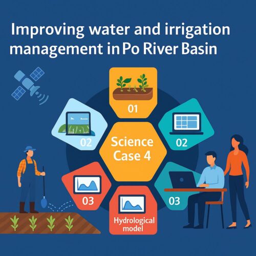
Science Case 4 (led by Valencia Polytechnic University): Improving water and irrigation management in the Po River Basin
The Po river basin is characterized by considerable variability of the landscape and climate and, more importantly, by a strong human impact on the water cycle. Currently, we have only large-scale and rough estimates of the total water use in the Po basin, which may be representative of other basins in the world. By using the high-resolution model simulations and through their integration with high-resolution EO products the purpose of this science case is to answer the key question: How do LSMs and water balance improve when using EO information on irrigation? To account for irrigation, a high-resolution regional dataset for the Po was used, developed as result of the ESA Irrigation+ project. It employs a soil moisture (SM) based inversion approach1 from EO data to produce an irrigation dataset with a 1km resolution and a weekly aggregation from January 2016 to December 2021. Using this irrigation dataset added to EMO1 as precipitation input, four (4) LSM/HMs models: TETIS, mesoscale Hydrologic Model (mHM)5, PCRaster Global Water Balance (PCR-GLOBWB) and Community Land Model (CLM), were run at two spatial resolutions: 5 km and 1 km. The water balance components and models’ performances were compared across three modelling experiments: The first WP5 experiments 20 and 21 at 5km and 1km resolution respectively, used only EMO1 precipitation as input and models were calibrated against discharge measurements. This setup is referred to in this document as SC40. The second experiment, named SC41, uses the irrigation data added to EMO1 as rainfall input without model calibration. And the third experiment, SC42, corresponds to the calibration of experiment SC41 against a naturalized discharge dataset, estimated as the sum of observed flow series and irrigation water abstractions10 at several stations on the Po river. The results indicate that all the variables considered, evapotranspiration, discharge, surface soil moisture and total water storage are sensitive to the inclusion of irrigation. In experiment SC41, changes are concentrated in the irrigated areas, whereas in SC42, the effects are distributed over the whole basin. Focusing on the water balance, the inclusion of irrigation in SC41 leads to an increase in evapotranspiration compared to baseline at both spatial resolutions. In contrast, SC42 shows a decrease in evapotranspiration, possibly due to an overestimation in the baseline. After applying the post-process removal of abstractions, all models in SC41 show a decrease in discharge, except for PCR-GLOBWB. These inconsistencies are partly due to the lack of calibration, which was addressed in the SC42 experiment. Results from SC42 demonstrate an overall improvement in the representation of basin-scale fluxes and storage after calibration. Performance also improves on the SC42, as shown by higher Kling-Gupta Efficiency (KGE) values at both daily and monthly timescales. These results suggest that the incorporation of EO-based irrigation products can improve hydrological simulations at both fine (1 km) and coarse (5 km) resolution over the Po basin. Such improvements may have implications for other basins affected by irrigation practices, although further research is needed to better understand the differences between model results. For the full report of this science case, click here.

Science Case 3 (led by Utrecht University): Investigating the added benefit of EO products for simulating reservoir operations
Although reservoir operations have strong impacts on local to regional surface water hydrology, many land-surface and hydrological models simply ignore reservoir operations altogether. For those land-surface and hydrological models that do include reservoir operations, operations often rely on generalized rules that may not be suitable for all reservoirs. Therefore, the aim of science case 3 is to investigate the added benefit of EO products for simulating reservoir operations. To investigate the added benefit of EO product, we compared EO-based reservoir storage estimates of GloLakes with discharge observations up and downstream of reservoirs in the Tugela river basin in South Africa, the primary region of interest. GloLakes provides valuable information on reservoir storage dynamics, which allows for estimating potential reservoir impacts on discharge. However, our results show that the reservoirs in the Tugela river basin have an insubstantial impact on the surface hydrology. No substantial discharge alternations were identified from the discharge observations, and the variability in reservoir capacity and storage was relatively small compared to the annual discharge. Our science case continued to the Italian Po river basin, the secondary region of interest. Unfortunately, no EO-based reservoir storage estimates are available in this region, as the spatial coverage of GloLakes is limited and does not cover the region’s major reservoir. Therefore, we relied on hydrological simulations, both with and without reservoir operations, of surface hydrology to estimate the impact of reservoir operation in the Po river basin. Our results indicate that larger reservoirs in the Po river basin have an insubstantial impact on discharge, whereas smaller reservoirs can strongly affect discharge locally. Due to the limited impacts of reservoirs in the Tugela basin and the lack of EO-based observations in the Po, our science case could not conclusively investigate the added benefit of EO products for simulating reservoir operations. Nevertheless, the potential of EO-based reservoir storage estimates are substantial. Not only will such EO-based products allow for correcting hydrological simulations without reservoirs, but they would also allow better approximation of reservoir operation rules, tailored to individual reservoirs. Therefore, further investment in EO-based reservoir storage estimates, especially in highly managed river basins, is needed to improve the state-of-the-art in hydrological modelling. Figure 1: Simulated multi-year monthly median discharge (m3 s-1) with and without reservoirs for the Miorina reservoir. Colors indicate the hydrological models whereas linetypes indicates simulations with and without reservoirs. The shaded area indicates the 25th to 75th percentile range. Although high-resolution satellite, hydrological, and land surface models are advancing, accurately understanding the water cycle in catchments remains challenging due to uncertainties in data accuracy, spatial variability, and the complex interactions between surface and subsurface processes. This science case leverages multiple state-of-the-art satellite datasets and hydrological/land surface models. We evaluated the water cycle closure for the Po River Catchment using 84 different combinations of precipitation, actual evapotranspiration (ET), and runoff. This assessment incorporated Earth-observed precipitation (CNR-IRPI combined product) and evapotranspiration (MODIS Terra), selected based on the round-robin evaluation conducted in WP4, along with outputs from six models—mHM, PCR-GLOBWB, CLM, TETIS, Wflow, and GEOframe—within WP5-Experiment 2. For the Rhine River Catchment, the evaluation included 40 combinations, based on the outputs of four hydrological models: mHM, PCR-GLOBWB, CLM, and Wflow_sbm. Similarly, for the Tugela River Catchment, 40 combinations were evaluated using outputs from the models: mHM, PCR-GLOBWB, TETIS, and Wflow_sbm. Fig. 1 shows the scheme of different combination over this study. The heatmaps in Fig. 2 present the primary results, showing annual water cycle residuals for various combinations of precipitation, ET, and runoff across the different catchments. Lighter shades of red or blue indicate smaller residuals, meaning a better closure of the water budget in each catchment. For the full report of this science case, click here.
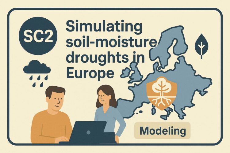
Science Case 2 (led by UFZ): Simulating soil-moisture droughts in Europe
Over the past decade, Europe has faced multiple severe droughts, primarily triggered by prolonged low rainfall and high evaporation rates (e.g., Naumann et al., 2021; Rakovec et al., 2022). These conditions significantly deplete root-zone soil moisture, which is crucial for plant growth and survival. While rainfall is widely monitored across Europe, data on evaporation and soil moisture, especially at large scales and high spatial resolution, remain scarce. To gain a deeper understanding of soil moisture drought development and temporal changes, we can integrate data from hydrological/land surface models with satellite-based Earth Observation (EO) products, and we aim to quantify their differences. This combined approach has the potential to enhance drought representation in models and improve future drought predictions. This science case aims to assess the effectiveness of EO products in improving model simulations of soil moisture droughts. We compare various configurations of five different hydrological models. These models were used to simulate hydrological processes using both default and calibrated settings, and forced with two different precipitation datasets: in-situ gridded meteorology (based on EMO-1) and EO precipitation input data (CNRIRPI) We consistently evaluate these model experiments using the Soil Moisture Index(SMI) (Samaniego et al., 2013) to identify dry periods. Our analysis will focus on the Rhine basin as a key study area, examining the period from 2007 to 2020. We assess how SMI results vary across different model setups in a spatially distributed manner, specifically for selected drought events. Furthermore, we validate the model outputs against soil moisture data from the NSIDC SMAP satellite (1 km resolution, selected from a round-robin exercise) and point-scale observations from the International Soil Moisture Network (ISMN). This helps us determine if higher-resolution simulations yield more accurate results. For the full report of this science case, click here. Naumann, G., Cammalleri, C., Mentaschi, L. and Feyen, L. (2021). Increased economic drought impacts in Europe with anthropogenic warming, Nature Climate Change 11: 485–491. Rakovec, O., Samaniego, L., Hari, V., Markonis, Y., Moravec, V., Thober, S., Hanel, M.and Kumar, R. (2022). The 2018–2020 multi-year drought sets a new benchmark in Europe, Earth’s Future 10 (3): e2021EF002394. Samaniego, L., Kumar, R. and Zink, M. (2013). Implications of parameter uncertainty on soil moisture drought analysis in germany, Journal of Hydrometeorology 14 (1): 47–68.
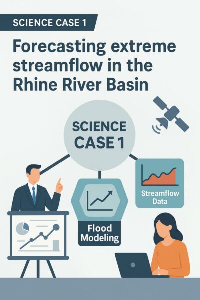
Science Case 1 (led by FZJ): Forecasting extreme streamflow in the Rhine River Basin
Simulating extreme hydrological events is a critical task for effective water resource management. Hydrological models are among the most widely used tools for estimating and predicting extreme events in river basins with sufficient lead time. However, despite the use of physically based models or the application of robust calibration techniques for more conceptual hydrological models, significant challenges remain. These challenges primarily stem from uncertainties associated with state variables, such as soil moisture and snow water content, prior to the occurrence of extreme events. Earth Observation (EO) products provide spatially continuous, near real-time information that can significantly enhance the representation of these states in hydrological models. To investigate the added value of EO products, this study explores the use of soil moisture remote sensing products with the aim of modifying the initial soil moisture conditions prior to the occurrence of extreme hydrological events (floods and droughts) in two major river basins in Europe. We compared the performance of two hydrological models initialized with EO-based soil moisture data against models initialized without the use of EO products. Specifically, soil moisture data derived from both Sentinel and SMAP were used for this purpose. The methodology was applied as a case study in the Po River Basin, focusing on the 2019 flood and the 2022 drought, and the Rhine River Basin, focusing on the 2018 drought and the 2021 flood. The proposed approach systematically evaluates the role of EO products in enhancing the representation of pre-event hydrological states and their impact on capturing the magnitude and timing of extreme streamflow events by the comparison of two land surface models (mHM and CLMv3.5). The results indicate different performances based on the event type (flood or drought), the basin studied, and the hydrological model used. In the Rhine River basin, the CLM model achieved better agreement with observed streamflow when forced with EO-products, especially during flood events. By contrast, the mHM model showed no significant improvement in streamflow simulations. While this study aims to demonstrate the potential of EO soil moisture products to improve hydrological modeling, several limitations were identified in the analysis. The analysis is based on a limited number of extreme events and initialization dates, which may not fully capture the variability and complexity of extreme events. Additionally, the focus is exclusively on soil moisture, excluding other hydrological variables that significantly influence the occurrence of extreme events. Furthermore, the EO products were only tested in two hydrological models (mHM and CLM), limiting the generalizability of the findings to other modeling frameworks. For the full report of this science case, click here.
Defining the Science Cases in WP6
Based on the outcomes of the Round Robin exercise and hydrological modelling activities in Work Package 5 (WP5), the project has identified five core science cases (SC), each addressing a key water-related challenge across different regions: SC1: Forecasting extreme streamflow in the Rhine River Basin – led by FZJ, SC2: Simulating soil-moisture droughts in Europe – led by UFZ, SC3: Assessing the added value of Earth Observation (EO) products for simulating reservoir operations and their impacts on hydropower potential and water, resources in the Tugela River Basin – led by UU, SC4: Improving water and irrigation management in the Po River Basin – led by UPV, SC5: Achieving water balance closure across all regions – led by UT. Stay tuned for upcoming posts, where we will present the results of each science case and highlight key publications will be emerging from this work.

Session HS2.2.1 in EGU25: Advancing Process Representation for Hydrological Modelling Across Spatio-Temporal Scales
Don’t miss this exciting session at the upcoming EGU Conference! Connect with leading experts and engage in meaningful and interesting discussions. Stay tuned for updates on the exact time and location!

What happened in the third milestone meeting?
The third milestone meeting took place in November 2024, featuring insightful discussions between the EO and modeling communities, alongside presentations of project results. Below are some general conclusions related to the project: The EO team should join the science cases, We need to translate the scientific results from the Science Cases to a story line that can be follow by non-scientists, Time is not an issue, and we can delay the end date of the project, but no extra money is available for that, In 2026, there would be some ESA money for opening a new call where 4DHydro could apply for an extension of the Science Cases. You can find the interesting results of the project and some other presentations here in this link.
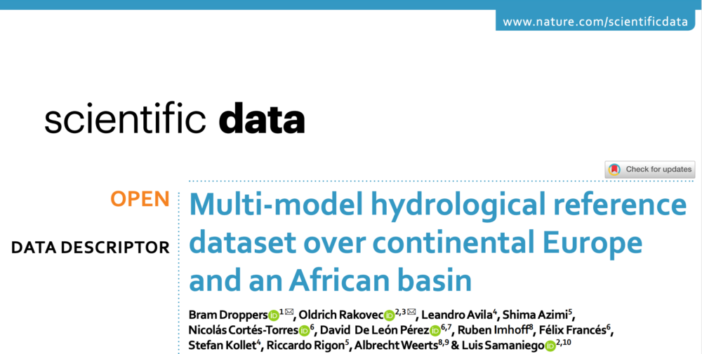
New Paper Released: Multi-model hydrological reference dataset over continental Europe and an African basin
We are excited to announce the publication of a new paper under the European Space Agency’s 4DHydro project: Hyper-resolution Earth Observations And Land-surface Modeling For A Better Understanding Of The Water Cycle Here is a summary of the paper: Although Essential Climate Variables (ECVs) have been widely adopted as important metrics for guiding scientific and policy decisions, the Earth Observation (EO) and Land Surface and Hydrologic Model (LSM/HM) communities have yet to treat terrestrial ECVs in an integrated manner. To develop consistent terrestrial ECVs at regional and continental scales, greater collaboration between EO and LSM/HM communities is needed. An essential first step is assessing the LSM/HM simulation uncertainty. To that end, we introduce a new hydrological reference dataset that comprises a range of 19 existing LSM/HM simulations that represent the current state-of-the-art of our LSM/HMs. Simulations are provided on a daily time step, covering Europe, notably the Rhine and Po river basins, alongside the Tugela river basin in Africa, and are uniformly formatted to allow comparisons across simulations. Furthermore, simulations are comprehensively validated with discharge, evapotranspiration, soil moisture and total water storage anomaly observations. Our dataset provides valuable information to support policy development and serves as a benchmark for generating consistent terrestrial ECVs through the integration of EO products. 📥 Explore the full dataset and results her