
Tutorial

What happened in the third milestone meeting?
The third milestone meeting took place in November 2024, featuring insightful discussions between the EO and modeling communities, alongside presentations of project results. Below are some general conclusions related to the project: The EO team should join the science cases, We need to translate the scientific results from the Science Cases to a story line that can be follow by non-scientists, Time is not an issue, and we can delay the end date of the project, but no extra money is available for that, In 2026, there would be some ESA money for opening a new call where 4DHydro could apply for an extension of the Science Cases. You can find the interesting results of the project and some other presentations here in this link.
Discover Useful Files: Explore Our Repository!
Interested in accessing the latest project outputs? Find out how to download them from this webpage. Interested in reviewing presentations from our last milestone meeting? Check out this repository.
Who is in charge for ground/EO data in the projcet?
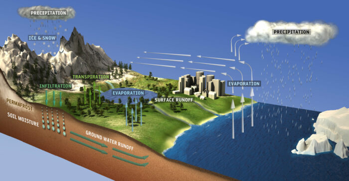
In the context of WP1, data preparation involves generating, consolidating, and cataloging a comprehensive reference Earth Observation (EO) dataset covering the project’s four study zones. This reference dataset comprises: – A high-resolution EO dataset, featuring products with resolutions below 1 km, encompassing various water cycle-related variables. – An additional products dataset containing other EO products at coarser resolutions. – A collection of in-situ datasets serving as references. The 4DHydro consortium proposes organizing the product collection into subtasks, each focusing on a specific variable or group of related variables (e.g., rivers and lakes products), led by the consortium partner with the most relevant expertise. Partners will host their own products whenever possible, while any remaining products (e.g., open data) will be referenced or hosted in a dedicated storage volume created for the project. Additionally, user manuals will be developed for each product by the leader of the corresponding subtask. Soil Moisture: TUW will supply high-resolution products from the Copernicus Global Land Service (CGLS), including SSM1km derived from Sentinel-1 and SWI1km derived from fused Sentinel-1 and ASCAT data (see webpage). Additionally, TUW will contribute a downscaled 1 km soil moisture (SM) dataset from the ESA CCI SM product (expected publication date: early 2023), while UFZ will provide a 1 km global surface soil moisture product based on a dual-channel algorithm using Sentinel-1 synthetic aperture radar observations (expected publication date: early 2023). Coarser resolution SM products, such as ESA CCI SM, will also be gathered in this work package. In-situ measurements from the International Soil Moisture Network will be collected, along with other site-specific measurements when available. Precipitation CNR-IRPI will build upon its experience from previous and ongoing ESA projects (SMOS + Rainfall, DTE Hydrology, 4DMED-Hydrology) to create a high-resolution (1 km, daily) precipitation product covering Europe. This product will merge two SM2RAIN-based (Soil Moisture to RAIN) products utilizing Sentinel-1 and ASCAT soil moisture data with GPM late Run satellite data. However, considering the limitations of satellite soil moisture data in mountainous areas and over snow/frozen soils, special attention will be given to these factors. Consequently, a high-resolution (1 km, 1 day) rainfall product derived from Earth Observation (EO) data will be developed and validated for hydrological applications. Evapotranspiration UFZ will collect the ECOsystem Spaceborne Thermal Radiometer Experiment on Space Station (ECOSTRESS) product, the MODIS global evapotranspiration product and other datasets generated for this project using the HOLAPS, ALEXI and DisALEXI models. Lower resolution products widely used in the literature, like the Global Land Evaporation Amsterdam Model (GLEAM) product, will be collected for comparison purposes. Additionally, evapotranspiration measurements from eddy covariance sites will be collected from different databases for the validation and evaluation of EO products. Lake, river water level change and river discharge Deltares will leverage on Global Water Watch and related ESA Surface2Storage project. Within these projects high-resolution EO data is used to quantify surface water extent, level and volume, by combining data from sensors that can capture these types of dynamics (e.g., Sentinel-2 for surface water extent, ICESat-2 for water levels), enhanced by in-situ measurements when available. The combination with hydrological models enables a detailed assessment of reservoir inflow and outflow, which in the case of large reservoirs is a critical component of the downstream flow regime. This data can additionally be used for calibration and/or validation of the models, which is also the case for the river levels and discharge data that are also part of this task. In-situ measurements of this kind will be collected for all study areas and supported by EO datasets. Snow cover and depth MobyGIS tracks snowpack evolution in selected mountain ranges, integrating physical models with EO data, particularly Sentinel constellation-derived snow-covered area data. The approach comprehensively describes domain characteristics, monitoring snow variables like snow-covered area, depth, water equivalent, and melt at high resolution for the Alps, Scandinavia, and mountainous regions of the Rhine and Po basins from 2000 to 2020. Data will be provided as 500 m resolution raster maps, aiding runoff assessment in various case studies. Meteo reanalysis data feeds the model, and in-situ snow depth observations, if available, enhance solid precipitation estimation and melting rate assessment during the melting season. Surface water dynamic mask CSGROUP has developed the Surfwater toolchain for the French Spatial Agency (CNES), generating surface water masks at 10m resolution from Sentinel 1 radar or Sentinel 2 optical images, or a combination of both. The toolchain utilizes the MAJA algorithm to mask or remove clouds in Sentinel 2 images. It can produce single masks or monthly mean water masks to reduce uncertainty. In 4DHydro, CSGROUP – France plans to generate dynamic water masks for the study regions using the Surfwater toolchain and other tools. They will merge products and produce corresponding uncertainty maps when feasible. Additionally, they will compile existing open datasets of dynamic surface water masks, such as Landsat Collection 2 (C2) Level-3 Dynamic Surface Water Extent (DSWE) or those from project partners. Irrigation area, time, and quantity In the ESA project Irrigation+, CNR, in collaboration with partners, is exploring, developing and validating advanced Earth Observation-based algorithms and techniques for irrigation mapping, quantification and detection of seasonal timing of irrigation from field to regional/global scale. The project capitalizes on the advent of the European Space Agency (ESA) Sentinel missions in synergy with other data types and models. In 4DHydro the results of Irrigation+, and particularly the regional products available at 1 km resolution for the Po and Ebro river basins. Indeed, the accuracy of the irrigation water product needs to be carefully checked before its use in large scale hydrological modelling. If successful, the integration of Irrigation+ and 4DHydro project results will constitute a ground-breaking result both in terms of scientific achievements and also for the operational management of water resources. Ground water storage and total water storage TUW will collect the satellite-based groundwater storage variations data generated within the H2020 project Global Gravity-based Groundwater Product (G3P, https://www.g3p.eu/). A preliminary groundwater product shall be released by the end 2022. Along with the EO groundwater dataset, we will collect in-situ
The applied models in the project
Models Land-surface and hydrological models (LSM/HMs) The reference dataset comprises eight LSM/HM models: Community Land Model (CLM), GeoFrame, mesoscale Hydrologic Model (mHM), Parflow-CLM, PCRaster Global Balance (PCR-GLOBWB), TETIS, Terrestrial Systems Modeling Platform (TSMP), and wflow_sbm. These encompass four hydrological models, two land-surface models, and one hybrid hydrological and soil-vegetation atmosphere transfer (SVAT) model. Table 1 outlines the datasets employed for model parameterization. Community Land Model (CLM) CLM, a key component of the Community Climate System Model (CCSM3), plays a crucial role in global climate studies. It covers various processes like biophysics, radiation interactions, heat transfer, hydrology, and vegetation characteristics. The version used in this study, CLM 3.5, introduces significant improvements in hydrological cycle simulation. Changes include updated surface datasets, enhanced canopy integration, scaled canopy interception, a simplified runoff model, a groundwater model, and a new frozen soil scheme. Modifications also address soil water availability, a resistance term for soil evaporation control, and nitrogen limitations on plant productivity. Notably, the CLM simulations in the reference dataset require no calibration; instead, they utilize a spin-up approach to achieve dynamic equilibrium by considering initial conditions and states. GeoFrame GeoFrame is a flexible computer-based hydrology system, offering a range of modeling solutions built on the Object Modeling system framework. With numerous components, it covers various aspects like rainfall-runoff, snow dynamics, evaporation, transpiration, infiltration, terrain analysis, interpolation, and calibration. GeoFrame supports diverse modeling paradigms, including process-based, lumped, and machine learning approaches. Notably, it accommodates spatially disjoint catchments, enabling modeling at different scales, from point to large catchments like the Blue Nile. mesoscale Hydrologic Model (mHM) mHM is a gridded distributed hydrological model developed by the Helmholtz Centre for Environmental Research GmbH (UFZ). It encompasses various processes including canopy interception, snow dynamics (accumulation and melt), soil moisture dynamics, infiltration, surface runoff, evapotranspiration, deep percolation, subsurface storage, baseflow, discharge generation, discharge attenuation, and flood routing. The model’s source code is highly modular and written in Fortran. mHM has been extensively applied in over 1,000 European basins and globally in more than 5,000 GRDC basins, spanning a range of sizes and spatial resolutions from 1 km by 1 km to 100 km by 100 km. Parflow-CLM ParFlow-CLM is an advanced, massively parallel hydrologic model specifically tailored for supercomputing environments, serving as a benchmark for supercomputing centers. It simulates variably saturated groundwater flow and overland flow while integrating land-surface processes such as evaporation and transpiration through the Common Land Model (CLM). The model’s application spans from test sites to continental scales, operating on sub-daily to climate time scales, and is utilized for scientific research as well as quasi-operational purposes globally. Moreover, ParFlow is a vital component of the Terrestrial Systems Modeling Platform (TSMP), which comprehensively addresses the terrestrial water and energy cycle from bedrock to the atmosphere. PCRaster Global Water Balance (PCR-GLOBWB) PCR-GLOBWB is a global hydrology and water resources model based on a grid system, developed at the Department of Physical Geography, Faculty of Geosciences, Utrecht University, the Netherlands. This model comprehensively represents the terrestrial component of the hydrological cycle. For each grid cell and daily time step, PCR-GLOBWB simulates moisture storage and water exchange between the soil, atmosphere, and underlying groundwater reservoir. The model fully integrates human water use, estimating demands for irrigation, livestock, industry, and households. These demands are then translated into actual withdrawals from groundwater and surface water sources, such as rivers, lakes, and reservoirs, considering water availability and maximum groundwater pumping capacity. TETIS TETIS is an eco-hydrological model with spatial distribution, developed by the Instituto de Ingeniería del Agua y Medio Ambiente (IIAMA) of Universitat Politècnica de València (UPV) since 1995. This model is versatile, accommodating a wide range of spatial scales from under 1 km² to 60,000 km², various spatial resolutions, and diverse climatic conditions worldwide. TETIS considers spatial heterogeneity in inputs, parameters, and state variables, offering sub-modules for reservoir operation, snow accumulation and melting, sediment erosion, transport and deposition, nitrogen cycle, natural dynamic vegetation, flood and drip irrigation, and crop production. The model incorporates satellite data, such as NDVI and surface soil moisture, in a multi-objective calibration process. Terrestrial Systems Modeling Platform (TSMP) TSMPis a fully integrated terrestrial model that balances water and energy from groundwater through the land surface to the atmosphere. It incorporates Parflow for variably saturated groundwater and surface water flow, CLM for land surface processes, and COSMO, the former weather prediction system of the German Weather Service, for atmospheric processes. wflow_sbm Wflow_sbm is a distributed hydrological model developed by Deltares, written in Julia. Initially based on the topog_sbm concept, it aims to balance between low-resolution, low-complexity (conceptual) and high-resolution, high-complexity (physics-based) hydrological models. Achieving this balance involves parameters grounded in physical characteristics or processes, maintaining relatively fast run times. The model encompasses various hydrological processes including glacier and snow dynamics, lakes and reservoirs (including operations), evapotranspiration, unsaturated zone dynamics, lateral subsurface flow, and multiple surface flow routing modules.
How reference data into STAC Catalog
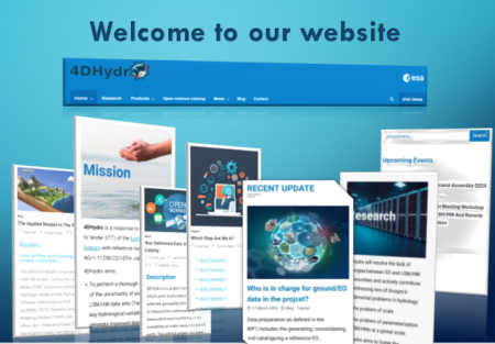
Description 4DHydro is a project funded by ESA which aims to provide a study of selected geospatial and climate data to improve the understanding, observation and monitoring of the availability of water resources planet earth. This GitHub project has been created to collect the metadata of the EO, LSM or Insitu data involved in this study, Features Centralizing the collection of metadata from all consortium partners Possibly open up the metadata contribution to other contributors at the end of the project. Verify the validity and consistency of metadata according to project specifications. Create a STAC catalog from this metadata, which will be automatically updated when new metadata is added. You can find the full tutorial on the following links https://github.com/4dhydro/4dhydro-open-science-catalog-metadata